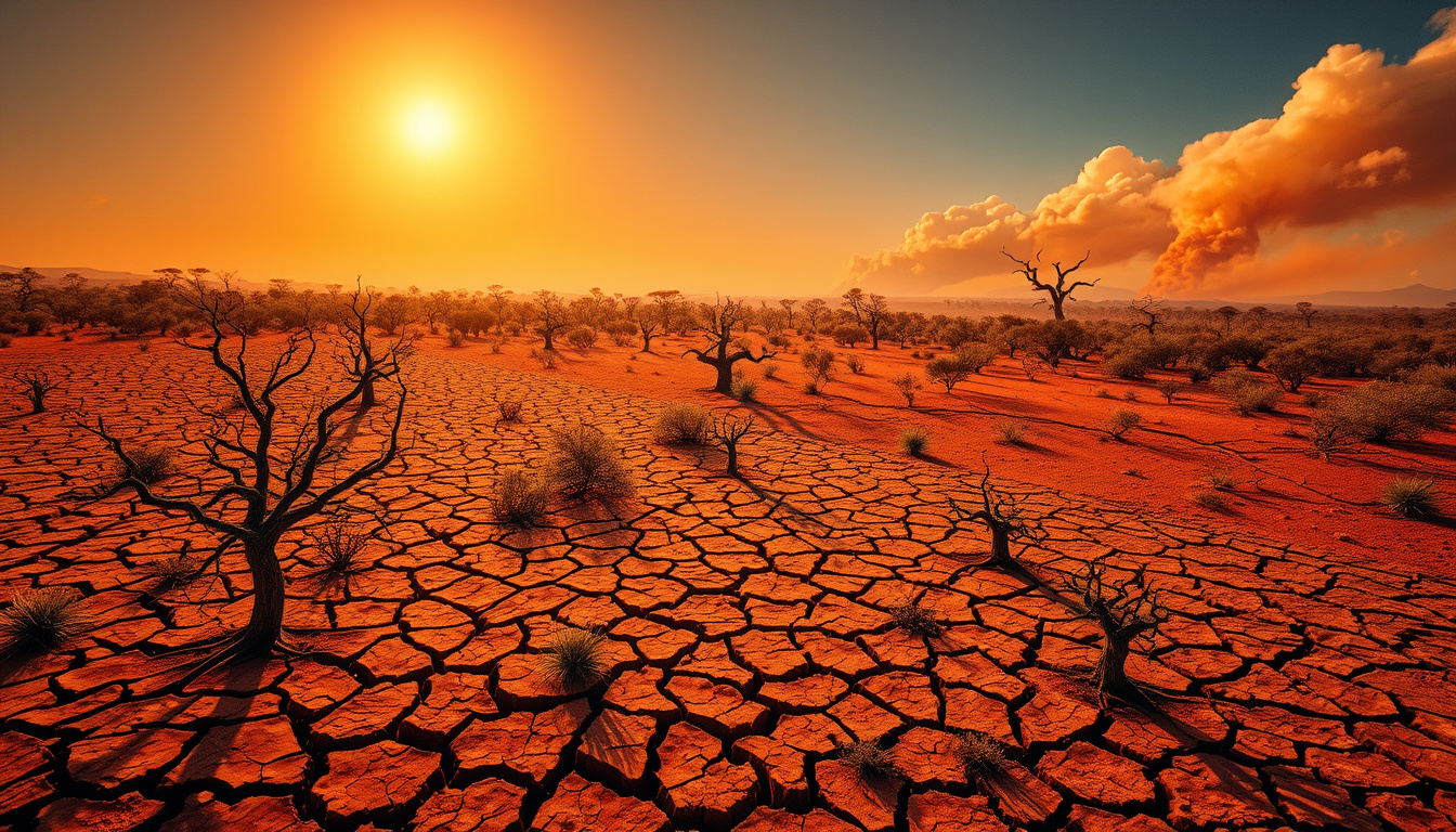
After years of La Niña deluging Australia’s north and east, a dramatic shift is taking shape in the Pacific. Climate models now point to an emerging El Niño that could rank among the strongest on record — with forecasts showing a 25% probability of a “super” event by the end of 2026. For Australians bracing for summer, the implications are anything but abstract.
Duration: 9–12 months ·
Super El Niño threshold: ≥2.0°C above average sea-surface temperatures ·
Current ENSO status: Neutral ·
BoM forecast: Below average rainfall May–April 2026 ·
Typical impacts: Warmer, drier weather across large parts of Australia
Quick snapshot
- ENSO currently neutral (Bureau of Meteorology)
- Sub-surface anomalies exceed 6°C in the equatorial Pacific (Weatherzone)
- BoM long-range forecast issued April 2026 (Bureau of Meteorology)
- Below average winter/spring rainfall in eastern Australia (WMO)
- Above average spring and summer temperatures (ABC News)
- Reduced tropical cyclones in northern Australia (Weatherzone)
- El Niño onset likely May–June 2026 (WMO)
- NOAA places 25% chance of very strong El Niño by end of 2026 (Weatherzone)
- Below average rainfall forecast for eastern and southwest Australia May–July 2026 (Bureau of Meteorology)
- Stronger El Niño does not always mean bigger impacts; Indian Ocean Dipole also plays a role (Bureau of Meteorology)
- Potential persistence into 2027 if oceanic heat content remains elevated (Weatherzone)
- Queensland may see normalized conditions due to warmer surrounding waters (ABC News)
The table below summarizes the key parameters that define El Niño and its projected impacts on Australia through 2026.
| Factor | Details |
|---|---|
| Event Type | El Niño–Southern Oscillation |
| BoM El Niño Threshold | ≥0.8°C in Niño 3.4 region |
| Super El Niño Threshold | ≥2.0°C in Niño 3.4 region |
| Primary Effect on Australia | Drier conditions, especially in winter/spring |
| Recent Occurrence | 2023–2024 moderate to strong El Niño |
| NOAA Very Strong Probability | 25% by end of 2026 |
| Historical Rainfall Impact | 40% below average winter/spring in eastern Australia |
| Subsurface Temperature Anomalies | >6°C in equatorial Pacific |
What does El Niño mean for Australia?
When El Niño takes hold, Australia typically faces a distinctive weather pattern: below-average rainfall concentrated in winter and spring, paired with above-average daytime temperatures outside the tropics. The Bureau of Meteorology confirms that El Niño’s drying influence historically extends over central and eastern Australia, while a long-term drying trend over southern Australia further reinforces these forecasts. The mechanism is straightforward — weakened trade winds allow warm water to accumulate in the central and eastern Pacific rather than near Australia’s coastline, suppressing the moisture-laden systems that typically bring rain to the continent’s east and south.
Typical weather impacts
El Niño reshapes Australia’s seasonal outlook in several measurable ways. Historical data from past events shows rainfall reduced by approximately 40% below average during winter and spring across eastern Australia. Above-average temperatures follow, particularly in spring and summer, extending the fire season and increasing the frequency of extreme hot days and heatwaves. The combination of reduced moisture and heightened evaporation amplifies drought conditions, while the southeast faces elevated fire risk from prolonged dry spells. In northern Australia, tropical cyclone activity tends to decrease, and the monsoon arrives later than usual.
El Niño does not bring dry summers to Australia — one of the most persistent myths about this climate pattern. Summer rainfall remains largely unaffected; the impact concentrates on winter and spring moisture, which means the bushfire season peaks later, after landscapes have dried out over preceding months.
The pattern is consistent across historical events: dry winters and springs followed by extended fire risk into autumn, with tropical cyclone activity suppressed in the north.
Historical effects
Australia’s experience with El Niño varies by decade and intensity. The 2023–2024 event delivered moderate to strong conditions lasting roughly 9–12 months, while earlier events in 2015–2016 and 1997–1998 produced severe drought and bushfire conditions across large swathes of the continent. The Bureau of Meteorology notes that while stronger El Niño events increase the likelihood of adverse impacts, the severity of actual weather outcomes depends on additional factors — most notably the Indian Ocean Dipole, which can either amplify or counteract El Niño’s drying influence in any given year.
The implication: historical El Niño events provide a useful template, but no single past occurrence guarantees what 2026 will deliver. Other climate drivers in play during mid-2026 will modulate the final outcome.
What is El Niño and how does it impact Australia?
El Niño is part of the El Niño–Southern Oscillation cycle, a natural fluctuation in ocean and atmospheric conditions across the tropical Pacific. The phenomenon operates on a roughly 2–7 year cycle, with each event typically persisting 9–12 months before conditions return to neutral or shift toward La Niña. El Niño events are declared when sea-surface temperatures in the Niño 3.4 region — a band of the central and eastern equatorial Pacific — rise to or above a defined threshold above the long-term average.
Definition and mechanism
The Bureau of Meteorology uses a 0.8°C threshold in the Niño 3.4 region to declare El Niño, compared to the US NOAA’s lower 0.5°C standard — a discrepancy that means Australian forecasts sometimes differ from American models in both timing and intensity classifications. A “super” El Niño, by contrast, reaches ≥2.0°C above normal in the same region, representing two standard deviations above historical averages. Weatherzone reports that current sub-surface temperature anomalies already exceed 6°C in parts of the equatorial Pacific, with that warmth potentially upwelling to the surface in the coming months.
Bureau of Meteorology insights
The Bureau of Meteorology’s long-range forecast, issued in April 2026, projects below-average rainfall for eastern Australia and parts of the southwest during May through July — a signal that aligns with developing El Niño conditions. BoM officials emphasize that El Niño strength does not always correlate with the severity of Australian weather impacts. The Indian Ocean Dipole, a separate but interacting climate driver, can either amplify or soften El Niño’s effects depending on its phase. A long-term drying trend over southern Australia further compounds these forecasts, making below-average rainfall increasingly likely regardless of El Niño’s exact intensity.
The WMO forecasts El Niño onset from mid-2026 with high confidence, following the so-called “spring predictability barrier” — the period when climate models gain reliability after the Southern Hemisphere’s autumn transition. This means the next several months are critical for confirming whether 2026 will deliver a standard or super-strength event.
What this means: the difference between a moderate and super El Niño matters less for Australia’s practical weather outlook than the broader pattern of warming oceans and declining winter rainfall that climate models now consistently project.
Is Australia currently in El Niño or La Niña?
As of April 2026, the ENSO system sits in a neutral phase — neither El Niño nor La Niña is active. The Bureau of Meteorology confirms this status, noting that conditions transitioned from the La Niña pattern that influenced Australia’s weather in 2025. However, sea-surface temperatures across the equatorial Pacific are rising rapidly, and model consensus increasingly points toward El Niño development within the next few months.
ENSO status today
Neutral ENSO conditions mean Australia is experiencing neither the enhanced rainfall associated with La Niña nor the drying influence of El Niño. This transitional period offers a window of relative normalcy, but it is short-lived. The WMO reports high confidence in El Niño onset after the spring predictability barrier, with conditions likely emerging as early as May–June 2026. Sub-surface ocean warmth exceeding 6°C below the surface provides the thermal fuel for potential rapid development.
Recent transitions
Australia has cycled through multiple ENSO phases in recent years. The moderate-to-strong El Niño of 2023–2024 gave way to a La Niña transition in 2025, which has since ended, leaving the neutral conditions now observed. This is consistent with the ENSO cycle’s typical rhythm — neutral phases typically bridge active El Niño and La Niña periods, lasting anywhere from a few months to over a year before the next event emerges. The speed and intensity of the current transition toward El Niño, however, has caught some forecasters off guard, with sub-surface warming developing faster than seasonal models initially projected.
The pattern of rapid transition from La Niña to potential El Niño within a single year underscores how quickly oceanic conditions can shift, leaving little time for water managers and emergency planners to adjust.
Is Australia in El Niño or La Niña 2026?
2026 is shaping up to be an El Niño year. The WMO forecasts El Niño onset from mid-2026, and the Bureau of Meteorology’s May–June 2026 rainfall forecast already reflects developing El Niño conditions across eastern and southwestern Australia. Meteorologists interviewed by The New Daily warn that a “super” El Niño — reaching ≥2.0°C in the Niño 3.4 region — could be developing, though exact peak intensities remain uncertain until surface temperatures catch up with the sub-surface warmth already observed.
2026 forecasts
Current model consensus points toward El Niño development within the next few months, with some models predicting a super El Niño event if Niño 3.4 temperatures reach or exceed 2.0°C above average. NOAA’s probability forecast places a 25% chance of a very strong El Niño by the end of 2026. The WMO’s high-confidence outlook for mid-2026 onset aligns with this projection, though the exact timing and peak intensity will depend on how quickly sub-surface warmth upwells to the surface and how existing ocean heat content distributes across the equatorial Pacific.
Summer outlook
For summer 2026–2027, Australians should expect above-average temperatures and an extended fire season if El Niño conditions persist into the warm months — which current projections suggest they will. The persistence of a strong El Niño into 2027 is plausible, given that events lasting 9–12 months frequently extend beyond their typical cycle when oceanic heat content remains elevated. Queensland may benefit from normalized or slightly above-average rainfall conditions as warmer surrounding waters counter some of El Niño’s typical drying influence, though this regional variation remains uncertain.
The 25% probability of a super El Niño by end of 2026 does not mean a 75% chance of a mild event. Other outcomes — including a standard strong El Niño with comparable impacts — remain statistically plausible. Travelers, farmers, and emergency planners should prepare for strong-event scenarios regardless of exact classification.
The catch: El Niño’s reputation as a “drought maker” for Australia is well-earned, but the relationship between event strength and impact severity is not linear. A moderate event coinciding with a positive Indian Ocean Dipole can produce harsher drying than a super El Niño paired with a negative IOD. This uncertainty does not reduce the need for preparation — it just means flexibility matters.
What does a super El Niño mean for Australia?
A super El Niño — defined as sea-surface temperatures reaching ≥2.0°C above average in the Niño 3.4 region — represents a significant departure from standard events. It does not automatically double the impact on Australia, but it raises the probability of more severe outcomes across multiple dimensions: rainfall deficits, temperature extremes, fire weather, and drought duration.
Super El Niño characteristics
The threshold for a super El Niño sits at roughly two standard deviations above the historical average for the Niño 3.4 region. At this level, ocean-atmosphere coupling intensifies, trade wind disruptions become more pronounced, and the warm water pool in the central and eastern Pacific reaches levels that can persist for extended periods. Sub-surface temperature anomalies currently exceed 6°C in parts of the equatorial Pacific — more than enough thermal energy to support super El Niño development if that warmth reaches the surface. The BoM threshold of 0.8°C for a standard El Niño declaration means that a super event would represent conditions approximately 2.5 times more intense than the minimum threshold for El Niño classification.
Potential 2026 effects
Should a super El Niño develop and peak toward the end of 2026, Australia would face a heightened risk of drought across southeastern and eastern regions through summer and potentially into 2027. Rainfall deficits of 40% below historical averages during winter and spring become more probable under super El Niño conditions, compounding existing long-term drying trends over southern Australia. Temperature anomalies would likely exceed those observed during standard El Niño events, increasing the frequency of extreme heat days and extending the bushfire season well into autumn.
- Below-average winter/spring rainfall across southeastern and eastern Australia — the region most sensitive to El Niño’s drying influence
- Above-average spring and summer temperatures with more frequent heatwave events
- Increased fire risk in southeast Australia due to prolonged drying and above-average temperatures
- Reduced tropical cyclone activity in northern Australia, potentially delaying monsoon onset
- Queensland and northern regions may experience less severe impacts due to warmer surrounding ocean waters
- Potential persistence into 2027, extending the dry period beyond a single calendar year
The implication: a super El Niño would not merely intensify standard El Niño impacts — it would raise the floor for what “dry” and “hot” mean in the Australian context. Communities, emergency services, and travelers who prepare for a strong event now, rather than waiting for official confirmation, give themselves the best available window for adaptation.
Timeline signal
Key dates and forecasts that shape the current El Niño outlook for Australia through 2027.
| Period | Event | Source |
|---|---|---|
| Early 2026 | Current ENSO neutral with rising sea-surface temperatures | WMO |
| April 2026 | BoM long-range forecast issued | Bureau of Meteorology |
| May–April 2026 | El Niño onset likely; below average rainfall forecast for eastern and southwest Australia | WMO · BoM |
| End of 2026 | Potential super El Niño peak; 25% chance of very strong event | Weatherzone |
| Into 2027 | Possible El Niño persistence if event is strong | Weatherzone analysis |
What’s known and what remains unclear
Confirmed facts
- El Niño weakens trade winds and reduces rainfall over central and eastern Australia
- The BoM threshold for El Niño declaration is ≥0.8°C in the Niño 3.4 region
- A super El Niño is defined as ≥2.0°C above average in Niño 3.4
- ENSO is currently neutral as of April 2026
- WMO forecasts El Niño onset from mid-2026 with high confidence
- BoM projects below-average rainfall May–April 2026 for eastern and southwest Australia
- Historical El Niño events reduce winter/spring rainfall by roughly 40% in eastern Australia
- El Niño does not significantly affect summer rainfall — the impact targets winter and spring
- Stronger El Niño events increase the likelihood of adverse impacts but do not guarantee severity
- Sub-surface temperature anomalies currently exceed 6°C in the equatorial Pacific
What’s unclear
- Exact peak Niño 3.4 temperature — whether it reaches super El Niño thresholds remains uncertain
- Precise 2026 rainfall deficits by state and region
- Whether the Indian Ocean Dipole will amplify or counteract El Niño effects in 2026
- Exact timing of sub-surface upwelling to the surface
- Whether a strong El Niño will definitively persist into 2027 or dissipate earlier
- How Western Australia’s rainfall patterns will respond to the developing El Niño
The balance between confirmed mechanisms and these uncertainties means that while the direction of change is clear, the precise magnitude of 2026 impacts will only become apparent as El Niño either develops or fails to materialize in the coming months.
What experts say
“After a period of neutral conditions at the start of the year, climate models are now strongly aligned, and there is high confidence in the onset of El Niño.”
— Wilfran Moufouma Okia, Chief of Climate Prediction at World Meteorological Organization
“How strong an event is, does not always match the strength of its impact on our weather and climate.”
— Bureau of Meteorology (official statement)
“Dispelling one of the great El Niño myths, El Niños do not bring dry summers to Australia.”
— Meteorologist, analysis via ABC News
For Australians who remember the flooding rains of recent La Niña years, the coming shift toward El Niño represents a fundamental change in the country’s weather character. The transition from flood to drought risk, from extended cool seasons to prolonged heat, demands more than passive observation — it requires active preparation. Communities in southeastern and eastern Australia face the sharpest end of this shift, while Queensland and the north may experience a comparatively gentler impact. Travelers planning visits during late 2026 and early 2027 must factor in elevated heat and fire risk when choosing destinations and timing within those regions.
Related reading: Australian Broadcasting Corporation · State of Origin 2026
The Bureau of Meteorology’s 40C heatwave forecasts across states preview the intensified heat and drought risks that a developing El Niño could bring to Australia by 2026.
Frequently asked questions
What causes El Niño?
El Niño results from a breakdown in the normal atmospheric circulation over the tropical Pacific. Under neutral conditions, trade winds blow westward, piling warm water near Australia and Indonesia. When those winds weaken or reverse, the warm water shifts eastward toward the central and eastern Pacific, raising sea-surface temperatures in the Niño 3.4 region. This ocean warming disrupts typical rainfall patterns, pushing storms away from Australia and toward the Americas instead.
How does La Niña differ from El Niño in Australia?
La Niña is El Niño’s opposite. Stronger trade winds during La Niña push more warm water toward Australia, creating conditions for enhanced rainfall across northern and northeastern Australia, especially Queensland. El Niño does the reverse — it suppresses rainfall over central and eastern Australia, bringing drier winters and springs. The two phases alternate on a roughly 2–7 year cycle, with neutral periods in between.
What is the ENSO forecast?
The WMO forecasts El Niño onset from mid-2026 with high confidence following the spring predictability barrier. The Bureau of Meteorology’s May–July 2026 rainfall forecast already signals below-average precipitation for eastern and southwestern Australia. NOAA places a 25% probability of a very strong El Niño by the end of 2026. The event may persist into 2027 if oceanic heat content remains elevated.
Does El Niño increase cyclone risk in Australia?
No — El Niño typically reduces tropical cyclone activity in northern Australia and delays monsoon onset. The warmer central and eastern Pacific associated with El Niño creates conditions less favorable for cyclone formation near Australia’s north coast. La Niña, by contrast, tends to increase cyclone frequency in the region.
How did El Niño affect Australia in 2021?
Australia experienced a weak-to-moderate El Niño in 2021, which brought below-average winter and spring rainfall to much of eastern Australia and contributed to the severe bushfire conditions observed during the summer of 2021–2022. The event demonstrated how even a standard-strength El Niño can significantly dry the landscape and elevate fire risk across densely populated regions.
What are symptoms of heat-related risks during El Niño?
El Niño raises the frequency of extreme heat days and heatwaves across southern and eastern Australia during spring and summer. Risks include heat exhaustion, heatstroke during outdoor activities, strain on power grids from air conditioning demand, elevated bushfire danger, and crop stress for agriculture. Staying hydrated, avoiding outdoor exertion during peak afternoon heat, and monitoring BoM heatwave forecasts become especially important during El Niño years.
Can El Niño impact Australian wildlife?
Yes. Extended drought and reduced rainfall during El Niño events stress ecosystems across southeastern and eastern Australia. Freshwater availability for wildlife declines, food sources for birds and insects are disrupted, and bushfire risk — which directly threatens habitat — increases. Kangaroos, koalas, and bird species in drought-affected areas face habitat pressure, while aquatic ecosystems in rivers and wetlands suffer from reduced inflow.

Catherine Roy is Editor-in-Chief at Downunder Brief, overseeing editorial standards, publication decisions and corrections.